Global Warming Side Effects: NASA tool reveals ‘Mumbai’ at high risk of getting flooded
Mumbai, November 17: Global Warming is stirring up the levels of our planet and so the sea levels are also rising day by day. With new NASA tool, now we would be able to know which city will get flooded due to melting of glaciers. Thanks to NASA.
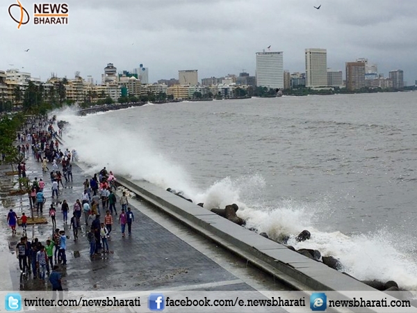
Mumbaikars, our Mumbai has the biggest threat as per NASA. Mangalore in Karnataka and Mumbai are at a high risk of encountering floods due to melting ice caps, a NASA report said. The insights are based on a forecasting tool, gradient fingerprint mapping (GFM) which help to predict how water will be “redistributed” globally.
By pinpointing which specific glaciers and ice sheets are contributing to local sea level rise for individual coastal cities, scientists can paint a more complete and accurate picture of what global warming will mean for rising ocean levels.
"This study allows one person to understand which icy areas of the world will contribute most significantly to sea level change (rise or decrease) in their specific city," Eric Larour, one of the study's authors, said.
In the past week up to 550 mm (21.7 inches) of rain poured over India's southeastern coast in the state of Tamil Nadu, NASA said in its website. Total rainfall in southeastern India was measured at around 200 mm (7.9 inches).
The Joint Typhoon Warning Center informed that computer models indicate that rains are expected to move in a northerly direction, wind speed is predicted at approximately 37 to 46.3 kilometers per hour, and with a minimum central pressure near 1004 millibars, NASA confirmed.
The low-pressure continued to produce heavy rain in Tamil Nadu and in remote areas over south coastal Andhra Pradesh, NASA revealed.
Over the next 100 years, the glacial melt may potentially raise Mangalore's sea levels by 15.98cm as and to 15.26cm in Mumbai and 10.65cm for New York, according to a study carried in the journal Science Advances.
“This tool provides, for each city, a picture of which glaciers, ice sheets, and ice caps are of specific importance,” researchers said.
“As cities and countries attempt to build plans to mitigate flooding, they have to be thinking about 100 years in the future and they want to assess risk in the same way that insurance companies do,” said Erik Ivins, senior scientist at NASA’s Jet Propulsion Laboratory in the US.