Want to see how Planet Earth looks groped with dust, sea salt and smoke?
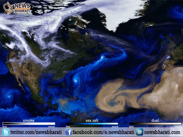
New Delhi, November 23: Want to see how Earth looks from space? Groped with dust, pollution! The Goddard Earth Observing System (GEOS) uses data from NASA satellites and computer models to track three aerosols in the atmosphere: smoke, sea salt and dust giving a different color to each.
Although often conflated with pollution, an aerosol can be any airborne particle, natural or human-made.
The video follows the three aerosols as they swirl about the Northern Hemisphere from Aug. 1 to Nov. 1, often settling thousands of miles from where they originated. Wind picks up dust from the Sahara desert and carries it west, where it gets caught in the storm systems of the mid-Atlantic Ocean. Smoke from fires in the Pacific Northwest wafts eastward across North American, eddying toward the Arctic like smoke from a blown-out candle.
The aerosols serve as markers for the often-invisible weather patterns scientists are interested in studying. For instance, the models show clear differences between Hurricane Ophelia and the other hurricanes of the season. While Harvey, Irma, Maria, and others headed west toward the Caribbean and Eastern Seaboard, Ophelia formed at a higher latitude, so it was exposed it to different wind patterns. The video shows how the storm was carried northeast, bringing dust from Africa and smoke from fires in Portugal toward the British Isles.
Tracking aerosols is only one of GEOS's features. The modular system can be deployed in many configurations. GEOS' power and customizability make it a versatile tool for a range of scientists studying different aspects of Earth science, NASA officials said. Much of the data fed into the model comes from the suite of satellites composing NASA's Earth Observing System mission.