Retaliation by nature? Seventh cyclone of year ‘Bulbul’ emerges off east coast; WB, Odisha, Andhra put on red alert
Total Views |
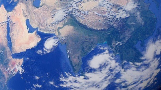
New Delhi, November 6: The seventh tropical cyclone, named ‘Bulbul’, of this year has emerged in the Bay of Bengal. The low pressure over North Andaman sea over Bay of Bengal has now turned into cyclonic storm and it is moving at a speed of 11kmph towards west-northwest direction.
The IMD has forecast rainfall over coastal Odisha and Andhra Pradesh from November 9 to November 12. Andhra Pradesh and Odisha districts of Kendrapara and Jagatsinghpur are gearing up to tackle the Cyclone. Bulbul will be the second cyclone to hit Odisha this year after Fani.
As per the information by IMD, the depression moved westwards and lay centred over east-central and adjoining southeast Bay of Bengal and North Andaman Sea, about 890 km south-southeast of Paradip in Odisha and 980 km south-southeast of Sagar Islands in West Bengal.
Squally winds with speeds reaching 40-50 kmph and gusting up to 60 kmph is likely to prevail over northwest Bay of Bengal off Odisha-West Bengal coasts from the evening of November 8, and gradually increase thereafter. District Balasore, Bhadrak, Kendrapara, Jagatsinghpur, Ganjam, Puri, Gajapati, Koraput, Rayagada, Nabarangpur, Kalahandi, Kandhamal, Boudh, Nuapada and Malkangiri have been put on red alert.
Is nature retaliating...?
“We are already on a par with 2018 when a record of seven Cyclones was made. It is very likely that in 2019, we may surpass the number of 2018,” said the weather forecasting agency Skymet. 2018 surpassed the Long-Period average (LPA) of cyclonic disturbances over North Indian Ocean areas. Last year had 14 such events while the annual average is 12 (1961-2017).
The Regional Specialised Meteorological Centre for Tropical Cyclones over North Indian Ocean (RSMCTC) has informed that The last such development of seven cyclones in a year occurred in 1985 (33 years back). It included two cyclonic storms, one severe cyclonic storm, three very severe cyclonic storms and one extremely severe cyclonic storm.
The cyclonic activities in the Indian Ocean usually start in spring, months before the monsoon, and end in December. A report states that The severe cyclone frequency in the north Indian Ocean (i.e., the Bay of Bengal and the Arabian Sea) has registered about a three-fold increase during the past decades. As compared to the previous decades, when about one severe cyclone was expected to form every year during the intense cyclonic period i.e. May, October and November, the number has now gone up to about three per year.
The studies associated with temperature suggest that the Indian Ocean is warming, particularly the Arabian Sea, which is doing so at the fastest rate. Previously, tropical cyclones in the Arabian Sea were restricted to Gujarat. In the past decade though, Kerala and Karnataka have also become more vulnerable to cyclones.
A research by veteran climatologist Hiroyuki Murakami reveals that 64 per cent of the cyclone risk in the Arabian Sea was due to climate change. It further warns that the coastal areas surrounding the Arabian Sea are at specific risk since the geographical location offers cyclones nowhere to go but the land.