"Correct the Map": A Revolt Against Imperialism & Journey Into A New World
Total Views |


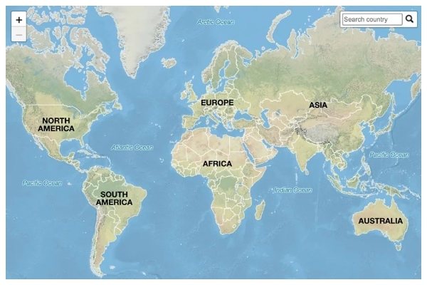
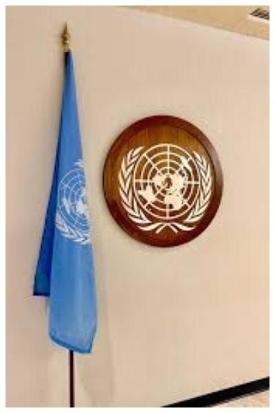
The world has suddenly discovered that even a map can become a political question. On September 4, the United Nations General Assembly adopted a resolution titled “Correct the Map”, calling for more equitable cartographic representation, particularly of Africa. The vote was 164 to 1, with six abstentions. Significantly, the only nation, which opposed the resolution, was the United States. India voted in favour. The immediate issue is technical. The familiar Mercator projection distorts the relative size of landmasses, especially towards the poles, while equal-area projections such as Equal Earth offer a different visual representation. But the significance of the resolution is much larger than cartography.
 But politics enters the story at another level. When one representation becomes the standard representation, repeated over generations in classrooms, atlases, offices and media, it begins to shape common sense. The map becomes not merely a picture of the world but part of the mental furniture through which the world is understood.
This is where colonialism and imperialism enter. Mercator was invented not only to glorify Europe, but as a history of knowledge and power. Imperialists required territory to be surveyed, measured, classified, named, bounded and administered. The colonial state did not rule through armies alone. It also produced categories, censuses, surveys, maps and archives. To map a territory was, in an important sense, to make it legible to power.
That is why the debate over maps deserves to be taken seriously without becoming intellectually lazy. The institutions of power determine which representations become authoritative. Once authority and repetition combine, a particular way of seeing can acquire the appearance of natural truth.
Alfred Korzybski’s famous proposition that “the map is not the territory” offers the philosophical key. Reality is one thing; our representation of reality is another. But human beings rarely encounter the world without representations. We organise experience through concepts, categories, statistics, maps, narratives and symbols. A representation may be imperfect and still become extraordinarily powerful.
There is also an important Indian dimension. Decolonisation cannot mean merely removing colonial flags, statues or names. It must also mean recovering the confidence and self-realization to examine inherited categories critically. India need not reject Western knowledge; it must refuse the assumption that knowledge becomes universal merely because it was institutionalised by powerful societies. Intellectual independence means being able to distinguish between useful knowledge and inherited hierarchy.
The most fascinating part of the story, however, is that the age of the paper map is giving way to the age of the algorithm. The new cartographers are search engines, social-media platforms, recommendation systems and artificial intelligence. They constantly construct maps of reality - what appears first, what is pushed down, what is highlighted, what is ignored, what is described as mainstream and what is labelled marginal.
Yesterday, imperial power could influence how territories were mapped. Today, technological power can influence how ideas, cultures, histories and people are mapped inside the digital mind. The question has moved from “Where is it?” to “How prominently does the system show it?” That is why the UN’s seemingly technical resolution deserves a larger reading. The struggle over representation never ends with paper. It concerns the relationship between knowledge and power, between reality and perception, between what exists and what people are taught to see.
A distorted map can misrepresent a continent. A distorted map inside the mind can misrepresent an entire civilisation. The first can be corrected by changing the projection. The second requires something harder -intellectual independence.
Every map is a compromise. The Earth is spherical - the map is flat. Something must be sacrificed area, shape, distance or direction. Mercator, created in the sixteenth century, was extraordinarily useful for navigation because it preserved angles and directions. The then navigation had a deep undercurrent of imperialism and spread of Christianity. Its weakness is that it makes territories nearer the poles appear much larger than they are. Thus Greenland can look comparable to Africa on a Mercator map even though Africa is vastly larger.
This is where colonialism and imperialism enter. Mercator was invented not only to glorify Europe, but as a history of knowledge and power. Imperialists required territory to be surveyed, measured, classified, named, bounded and administered. The colonial state did not rule through armies alone. It also produced categories, censuses, surveys, maps and archives. To map a territory was, in an important sense, to make it legible to power.
ALSO READ: Why Krishna’s Janmashtami is celebrated at Shiva temples in Goa
India knows this history intimately. The Great Trigonometrical Survey was not an innocent academic exercise detached from empire; geographical knowledge became part of the machinery through which British India was understood and governed. Colonialism therefore left behind more than political institutions. It left habits of description. The deeper legacy of imperialism was not simply that foreigners ruled; it was that systems created under foreign rule could become accepted as neutral descriptions of reality.
Antonio Gramsci understood this mechanism in a broader political sense. Hegemony does not depend entirely upon coercion. It works when a particular worldview becomes normal, familiar and apparently self-evident. Cartography can participate in such a process. The important question is therefore not simply who drew a map, but who established the standards by which the map came to be regarded as normal.
The UN resolution is therefore interesting because it represents a small but unmistakable revolt against inherited visual hierarchy. Its supporters argue that the world should be represented in ways that do not systematically exaggerate some regions and visually diminish others. The resolution does not abolish Mercator, nor does it impose a single compulsory projection. It encourages greater use of projections that represent relative area more accurately. That distinction matters. Correcting representation is not the same as rewriting geography.
There is also an important Indian dimension. Decolonisation cannot mean merely removing colonial flags, statues or names. It must also mean recovering the confidence and self-realization to examine inherited categories critically. India need not reject Western knowledge; it must refuse the assumption that knowledge becomes universal merely because it was institutionalised by powerful societies. Intellectual independence means being able to distinguish between useful knowledge and inherited hierarchy.
The most fascinating part of the story, however, is that the age of the paper map is giving way to the age of the algorithm. The new cartographers are search engines, social-media platforms, recommendation systems and artificial intelligence. They constantly construct maps of reality - what appears first, what is pushed down, what is highlighted, what is ignored, what is described as mainstream and what is labelled marginal.
ALSO READ: Gen Z: the youth of India: Peep into the future of India
A distorted map can misrepresent a continent. A distorted map inside the mind can misrepresent an entire civilisation. The first can be corrected by changing the projection. The second requires something harder -intellectual independence.