Issuing red alert, heavy rainfall lashes in coastal areas as Cyclone Fani moves towards WB
Kolkata, May 4: After making a horrific entry in Odisha, Cyclonic storm Fani has entered West Bengal crossing West Midnapur district. The extremely severe cyclone with wind speed of 175 kmph lashed Odisha on Friday morning. It has now weakened and moved in the Northeast direction with the wind speed of 90 kmph.
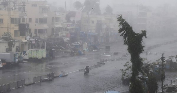
A red has been issued in coastal areas and fishermen have been asked not to venture into the sea. Several districts including East and West Midnapore, North and South 24 Parganas besides, Howrah, Hooghly, Jhargram, Kolkata and the Sundarbans are likely to be hit by the storm.
Assam government has directed all district deputy commissioners and agencies to be on and take necessary measures to deal with the situation in the wake of Cyclone Fani. Fani' is expected to trigger heavy rains in the northeast. Reports of heavy rainfall in the west and central Assam districts today and tomorrow has been forecasted so far. Special Secretary Land Revenue & Disaster Management, Rinzing Chewang Bhutia said that many parts of the state are likely to receive heavy rainfall accompanied by gusty winds.
Cyclone Fani is till now considered as the strongest storm to hit India since 2014. The cyclone is likely to move further north-north-east-wards and hit Bangladesh by this evening.