Enhancing the efficiency of revenue administration, Haryana signed MoU with Survey of India
Chandigarh, Mar 11: The Haryana is one of the developing states in India. Haryana with the wealth of agriculture and other resources making his own spot in development. For improving the efficiency of revenue administration, the Haryana Government signed the MoU with Survey of India for preparing geo-referenced cadastral revenue maps in the state.
As per the official statement, the project will cover the entire 44,000 sq Km of the state. In this project, maps were created by usage of unmanned aerial vehicles or drones.
The main purpose of this project is to replace existing manual revenue maps with updated geo-referenced digitalized cadastral maps of every property. This new method will enhance the effectiveness of revenue administration and help to plan the developmental project better.
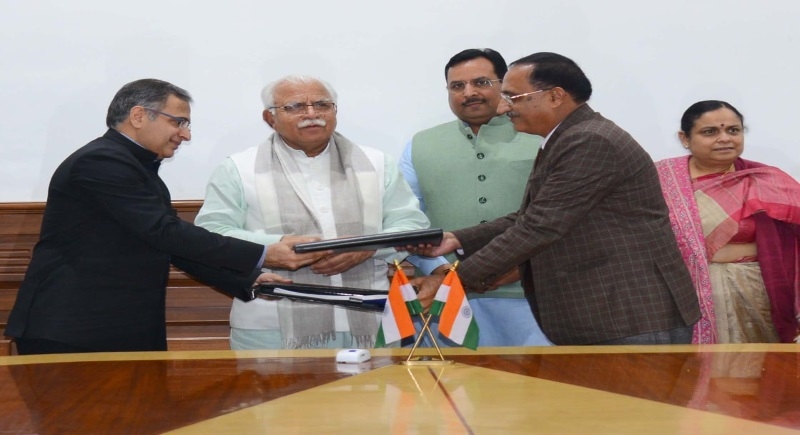
The MoU was signed by Surveyor General of India Lt. General Girish Kumar on behalf of the Survey of India and by the Secretary Revenue, Vijayendra Kumar, on behalf of the Haryana government in presence of Chief Minister Manohar Lal Khattar and other ministers.
An official statement said, A digitized, geo-referenced, accurate and up-to-date map of each land parcel and each property in urban areas will get generated and it will be completed in 18 months.
The drone or UAV-based survey not only takes lesser time but also costs less than the manual approach and eliminates human interference.