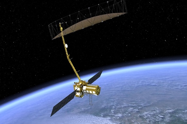
NISAR satellite to be Launched in 2024
Total Views | 50
Overexploitation of groundwater is a concerning issue in India, producing, among other things, soil subsidence.Mining, infrastructure construction, and other activities in the fragile Himalayas are also triggering ground subsidence and disasters, as the residents of Joshimath just discovered.

However, there have been no accurate measures of the changes that are occurring to the land or ice surfaces in various geographies within India, or even around the world.
The Himalayan glaciers are melting, but there is dispute regarding the pace of melt and when the rivers they feed may begin to dry up.However, we may soon have exact measurements of these and other events made by eyes in space.The NISAR satellite, the most ambitious project in India-US space collaboration to date.
NISAR (NASA-ISRO Synthetic Aperture Radar)
According to Laurie Leshin, Director of the famed Jet Propulsion Laboratory (JPL) in Pasadena, California, and NASA's NISAR Project Manager Phil Barela, the NASA-ISRO Synthetic Aperture Radar (NISAR), which began more than 15 years ago alongside India-US civil nuclear deal talks and the building of a strategic partnership between the two countries, the NISAR is on track to be launched in the first quarter of 2024.
Leshin and Barela were in Bengaluru to check on the status of NISAR at ISRO, indicating that the final testing and assembly of the spacecraft is nearing completion.
Over the previous nine months, 160 of their colleagues from JPL's NISAR team have flown to the U R Rao Satellite Centre and worked with their ISRO counterparts, hastening progress on the project after it was delayed into 2020-21 owing to the Covid epidemic.
A Multipurpose Satellite
The NISAR idea is deceptively simple. It combines an L-band and an S-band Synthetic Aperture Radar (SAR) on a single spacecraft platform that will be placed into a 747 km high orbit by a GSLV Mk II rocket. It is, nevertheless, an ambitious effort.
Using these sophisticated radars that can see through clouds, bad weather, and even foliage, NISAR is designed to monitor changes in the earth's land and ice surfaces around the world, sweeping 240 km wide swaths of these surfaces twice every 12 days, measuring elevation to a fraction of an inch and detecting changes down to centimeters or less by overlapping images from different sweeps.
These changes would be sufficient to determine the pace of land subsidence, the rate of glacier melt, changes in soil moisture (very essential for farmers), carbon content, and many other phenomena.
NISAR is essentially a climate change observation satellite, catastrophe monitoring satellite, and agricultural assistance satellite bundled into one.
The NISAR project exemplifies India and the United States' expanding relationship in space exploration and scientific research. It also serves as a reminder of the value of worldwide collaboration in solving global issues such as climate change and natural catastrophes.
source : AFI
Bharati Web


